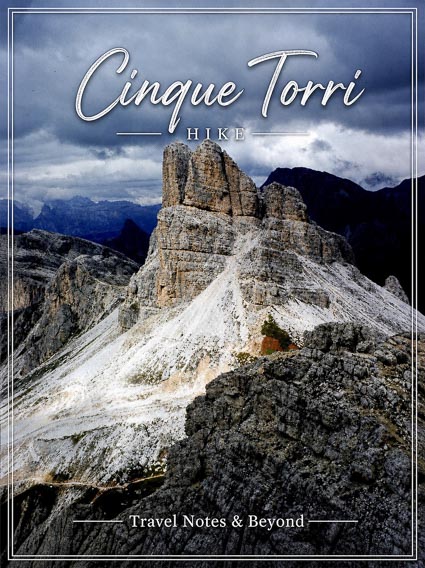
Cinque Torri loop is one of the best hikes you can do in the Italian Dolomites if you like the outdoors. Located in the Italian Alps, Cinque Torri (Five Towers) is a rock formation near Cortina d’Ampezzo, famous for its distinctive five towers and rich WWI history.
The UNESCO-listed mountain range of the Dolomites is characterized by dramatic scenery, jagged limestone peaks, sheer cliffs and vast alpine meadows. The grandeur of these mountains can only be compared to the fantastic Torres del Paine peaks in Chilean Patagonia. Although each offers unparalleled beauty in its own right!
We had a blast during this hike so we decided to put together a guide that will give you all the practical information you need for visiting Cinque Torri, so keep reading!
Table of Contents
- Key Aspects of the Cinque Torri Hike
- Getting to Cinque Torri Rock Formation
- Trail Route Variations: Choose Your Adventure
- How to Hike the Cinque Torri Loop Trail
- Other Hiking Options Near Cinque Torri
- Tips for Your Visit to Cinque Torri
- Essentials to Bring to Your Cinque Torri Hike
- Frequently Asked Questions About This Hike
Key Aspects of the Cinque Torri Hike
Length and Accessibility
Cinque Torri hike is a relatively easy loop that circles the distinctive “Five Towers” rock formation. The path that encircles the towers is about 3.5 km long (depending on the trail you choose) and has minimal elevation gain (120m), which makes it accessible for any type of hikers. The hike takes about 2 – 2.5 hours to complete, depending on how often you stop.
Scenery
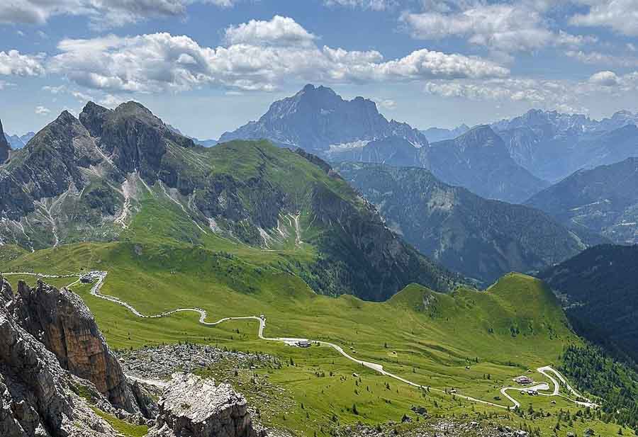
The scenery of Cinque Torri is stunningly beautiful, featuring incredible panoramic views of the surrounding Dolomite peaks like the Tofane and Lagazuoi. The area offers effortless access to easy hikes and also lots of history dating from the Great War. If you are really adventurous, you can also go rock climbing at Cinque Torri, but even if you are not in it for an adventure, this place will truly appeal to everyone.
Historic Importance
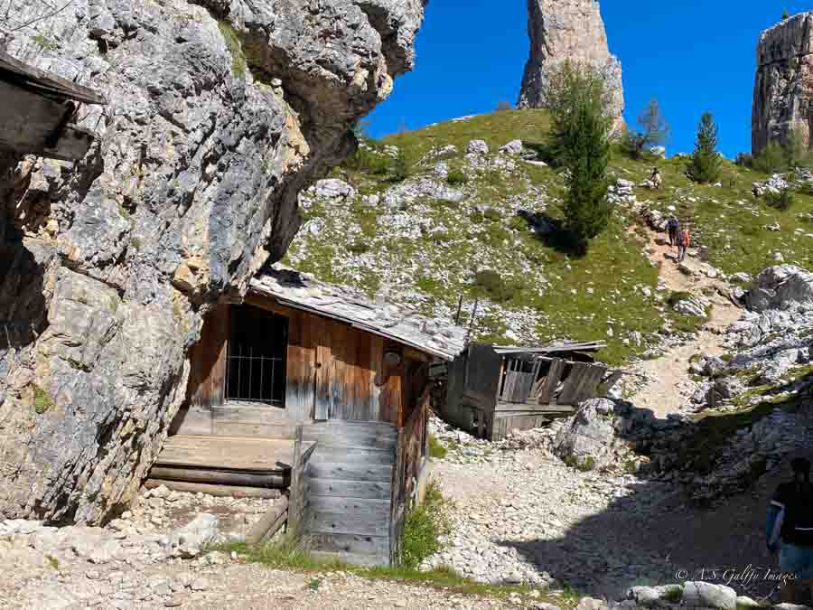
In addition to its natural beauty, the Cinque Torri hike is also a WWI open-air museum with informational panels and outdoor exhibits that make your hike even more interesting. During World War I (1915-1918) the Dolomites became a brutal mountain front between the Italian and Austro-Hungarian armies. The Italian soldiers built here an extensive tunnel network and fought bravely from ice caves and rocks. Sadly, they suffered more from avalanches, cold and rockfalls than enemy fires. They left behind tranches, bunkers and fortifications which you can still see today.
Getting to Cinque Torri Rock Formation
Starting Point
To reach Cinque Torri from Cortina d’Ampezzo you’ll have to drive towards Passo Falzarego and park at the Bai de Dones parking lot, which is located at the valley station near the Cinque Torri chairlift. The drive typically takes about 30 minutes. No parking reservation is needed.
On Foot
From the parking lot some people choose to hike up on foot to Cinque Torri. The hike starts at the bottom station of the cable car, but it’s a steep climb (from about 1.900m to 2.250m) and it’s not worth doing in my opinion. Unless of course you are in it for some strenuous physical activity. For the most part, this path follows the ski slopes and there isn’t even much vegetation on it.
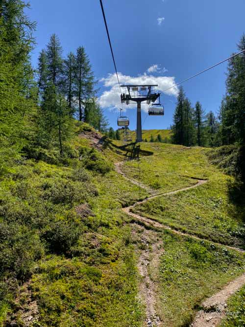
By Chairlift
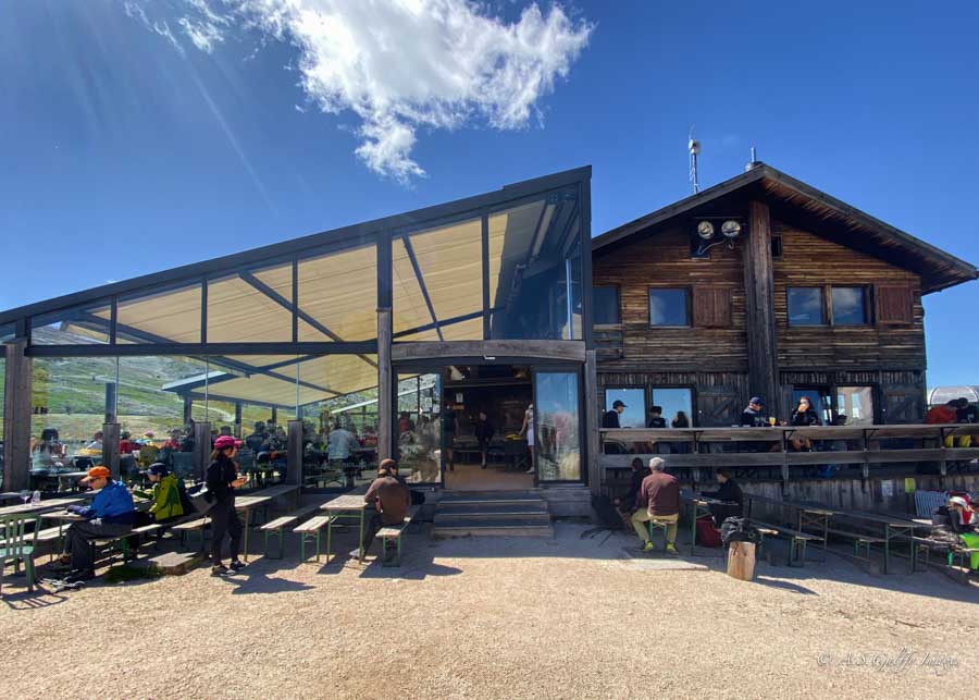
The easiest way to reach the Cinque Torri is to take the chairlift from Baita Bai de Dones to Refugio Scoiattoli. The ride takes about 6 minutes offering a quick ascent to the famous rock formations. It’s a short, scenic ride up to the refuge and a popular starting point for hiking in the area.
Updated Chairlift Pricing & Hours
The Cinque Torri chairlift operates from June 6 through October 11, 2026, running daily from 9:00 AM to 5:00 PM. Round-trip tickets cost €27.50-€30 per person depending on the month, while one-way tickets are available for €20.50. The scenic ride takes just a few minutes and delivers you directly to Rifugio Scoiattoli at the trailhead. If you’re visiting on a budget, you can hike up from the parking area instead—it’s a moderate 400-meter elevation gain that takes about 1.5 hours via trails 425/439. For the most current pricing and operating hours, check the official 5torri.it website before your visit.
Trail Route Variations: Choose Your Adventure
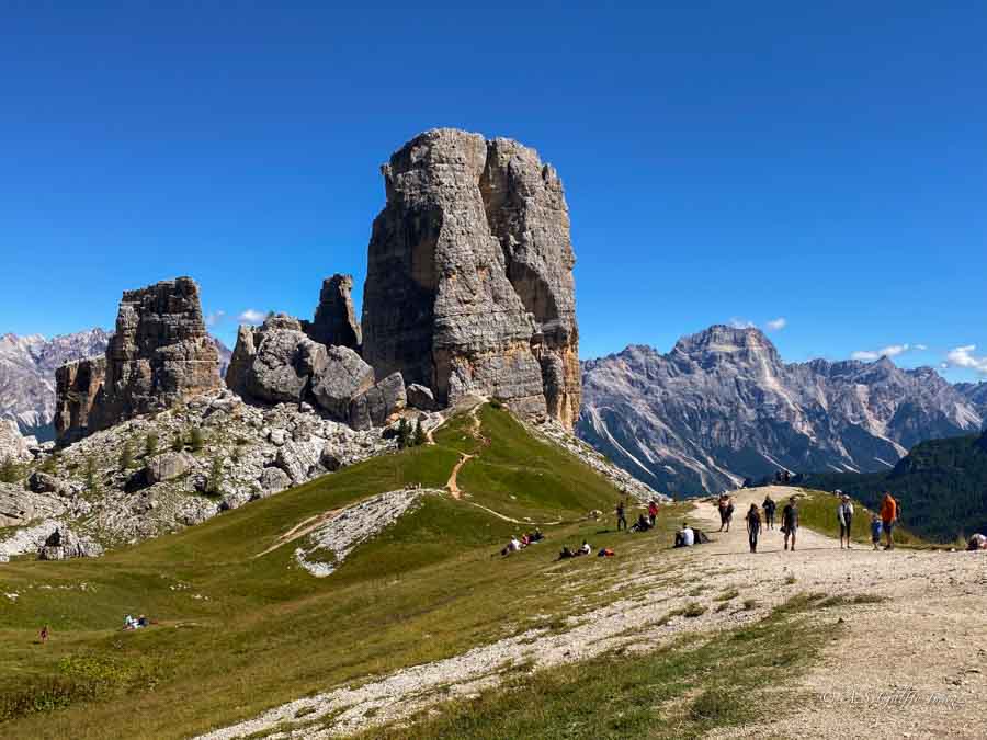
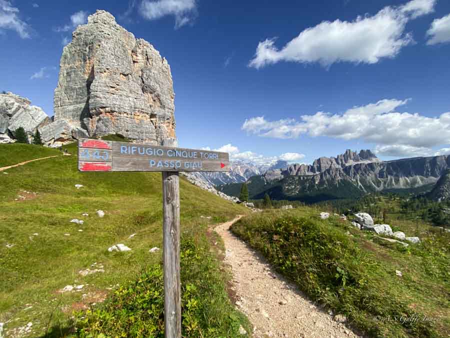
The Cinque Torri loop offers multiple route options depending on your time and interests. The full loop (approximately 3.5 km) takes you around the perimeter of the towers with panoramic views and access to WWI trenches—this is the classic experience most hikers choose. For a shorter option, take the purple shortcut route that cuts through the interior of the towers, reducing your hiking time by about 30 minutes while still offering impressive close-up views of the rock formations.
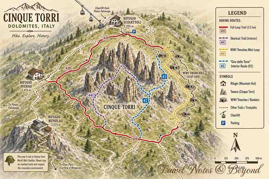
If you’re primarily interested in World War I history, consider the yellow WWI-only route that focuses on the extensive trench systems and military installations without completing the full tower circuit. For the most intimate experience with the towers themselves, follow trail #2 (blue route), known as the “Giro delle Torre,” which takes you through the interior of the Cinque Torri formation, including a dramatic natural tunnel between two of the towers.
Extending Your Hike: Rifugio Averau & Rifugio Nuvolau
If you have the time and energy, adding Rifugio Averau and Rifugio Nuvolau to your Cinque Torri hike transforms it from a scenic walk into one of the Dolomites’ most rewarding day hikes. This extension adds approximately 1.5-2.5 hours to your total hiking time but delivers jaw-dropping 360-degree panoramic views that make the effort worthwhile.
The Route to Nuvolau
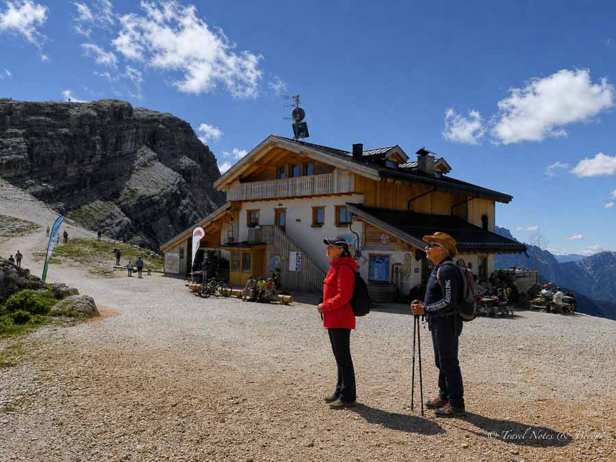
From Rifugio Scoiattoli, after completing your Cinque Torri loop, follow trail 439 toward Rifugio Averau. The hike climbs steadily upward with increasingly dramatic views opening up behind you. After about 45-60 minutes of moderate climbing, you’ll reach Rifugio Averau (2,413 meters), where you can take a break and enjoy views of the surrounding peaks.
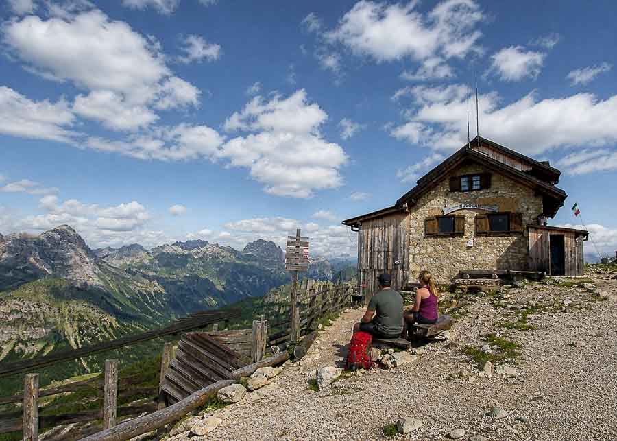
The final push to Rifugio Nuvolau is a 1-kilometer climb that takes approximately 30 minutes. This section is slightly more challenging, with steeper, rockier terrain and an elevation gain of about 160 meters. Follow trail 439 as it ascends a broad shoulder of rock—the path can be indistinct in places, but the route is straightforward and usually well-trafficked. Your reward is Rifugio Nuvolau, perched at 2,575 meters like an eagle’s nest, offering arguably the finest terrace views in the Dolomites.
What Makes Nuvolau Special
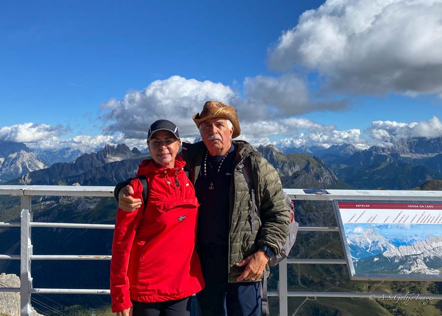
Rifugio Nuvolau’s elevated position provides unobstructed 360-degree views encompassing the Marmolada glacier, Tofana massif, Lagazuoi, and a bird’s-eye perspective looking down at the Cinque Torri you just hiked. The name “Nuvolau” means “cloud” in the local dialect, and on many days, you’ll understand why—the rifugio seems to float above the clouds. Plan to spend at least 30-45 minutes here soaking in the views and enjoying a well-earned drink or meal before retracing your steps back to Rifugio Scoiattoli.
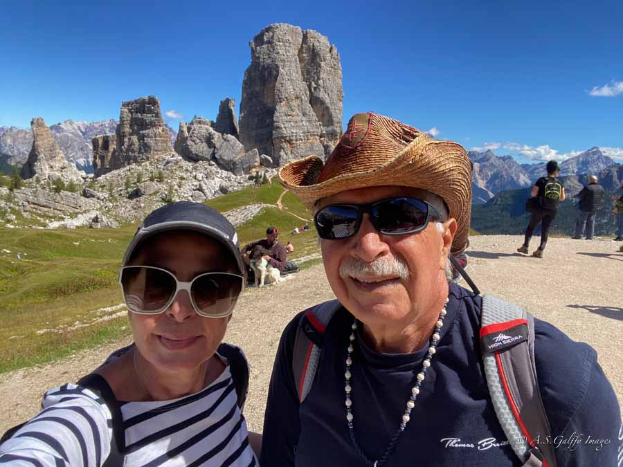
But if you are short on time and can only do one hike, you absolutely need to hike the Cinque Torri loop trail (Giro delle Torri), which is absolutely spectacular and not difficult at all.
How to Hike the Cinque Torri Loop Trail
For the best experience, my recommendation is to go clockwise, starting from Rifugio Scoiattoli towards the Sentiero delle Trincee (path of the trenches). This trail avoids the main climb and offers a relatively flat, scenic walk around the towers, including WWI bunkers and stunning panoramic views. The loop offers stunning views of the towers and passes by the WWI trenches and bunkers. Depending on your pace and how often you stop to explore the historic sites and take pictures, this loop may take 2-2.5 hours.
The Route in Detail
From Rifugio Scoiattoli, follow the well-marked trail signs toward the towers. Within just a few minutes, you’ll encounter your first WWI trenches on the left side of the path. These zigzagging defensive positions carved into the mountainside offer an immediate glimpse into the harsh reality of mountain warfare. Take your time exploring the interconnected trenches and bunkers—some have informational plaques explaining their strategic purpose during the Great War.
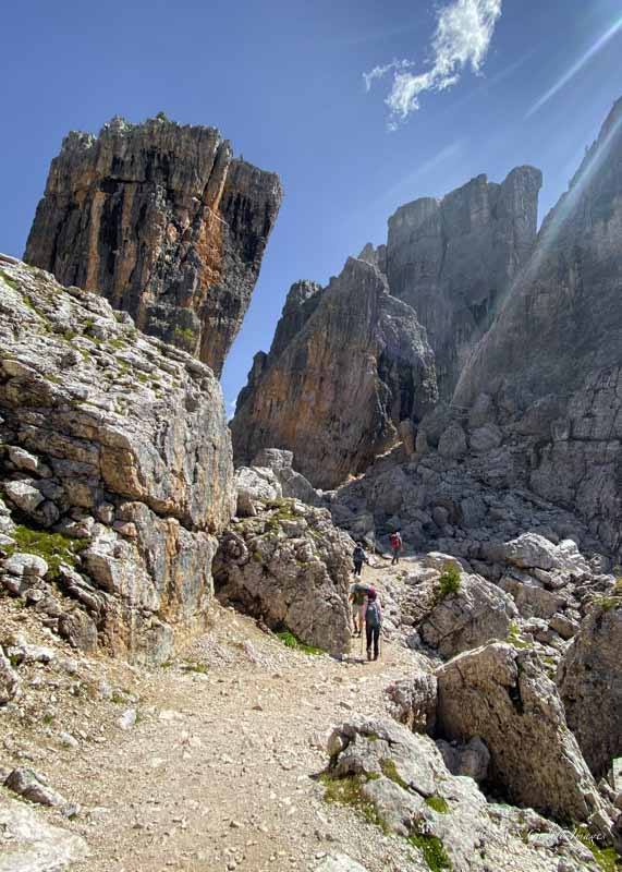
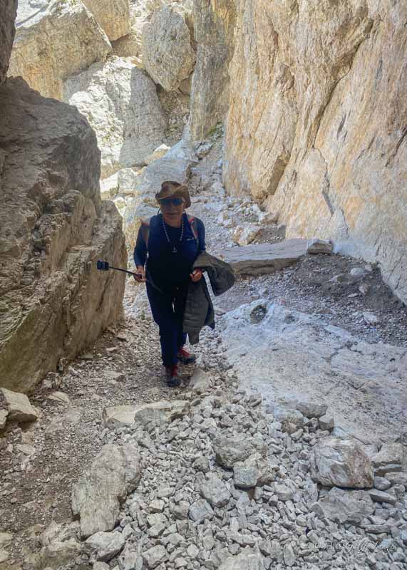
As you continue around the loop, the iconic Cinque Torri rock formations come into full view. The trail brings you close to the base of these dramatic limestone towers, providing excellent opportunities for photography from multiple angles. The path alternates between smooth sections and rockier terrain, but nothing technically difficult—just watch your footing on the uneven ground.
About halfway through the loop, you’ll reach the most extensive trench system. Here you can walk through covered bunkers and corridors where Austrian and Italian soldiers once lived and fought at over 2,000 meters elevation. If you brought a flashlight, this is where it’s most useful for exploring the darker interior spaces. The historic atmosphere is remarkably preserved, making it easy to imagine the conditions soldiers endured.
Tip: Some sections of this trail are steeper and rocky, but because it’s short and has little elevation gain, it feels like an easy hike.
The final section of the loop brings you back toward Rifugio Scoiattoli with sweeping views across the valley toward Cortina d’Ampezzo and the surrounding Dolomite peaks. The trail gradually descends slightly before closing the loop at your starting point.
What to Expect on the Hike
This loop is the easiest and most popular way to explore Cinque Torri. The trail is well-maintained and clearly marked with red and white paint blazes and numbered trail markers. You’ll share the path with other hikers, but it rarely feels crowded except during peak summer lunch hours. Depending on your pace and how often you stop to explore the historic sites and take pictures, this loop takes 2-2.5 hours to complete comfortably.
The elevation gain is minimal—less than 100 meters total—making this genuinely suitable for families and casual hikers. However, don’t underestimate the rocky sections: proper hiking boots or sturdy walking shoes are recommended over sneakers or sandals.
Other Hiking Options Near Cinque Torri
Cinque Torri pairs perfectly with other attractions along the Passo Falzarego route. The Lagazuoi cable car makes an excellent half-day addition. Alternatively, visit Lago di Federa or drive the scenic Passo Giau for sunset views. Planning a multi-attraction day maximizes your time in this stunning area of the Dolomites.
Laguzuoi Cable Car
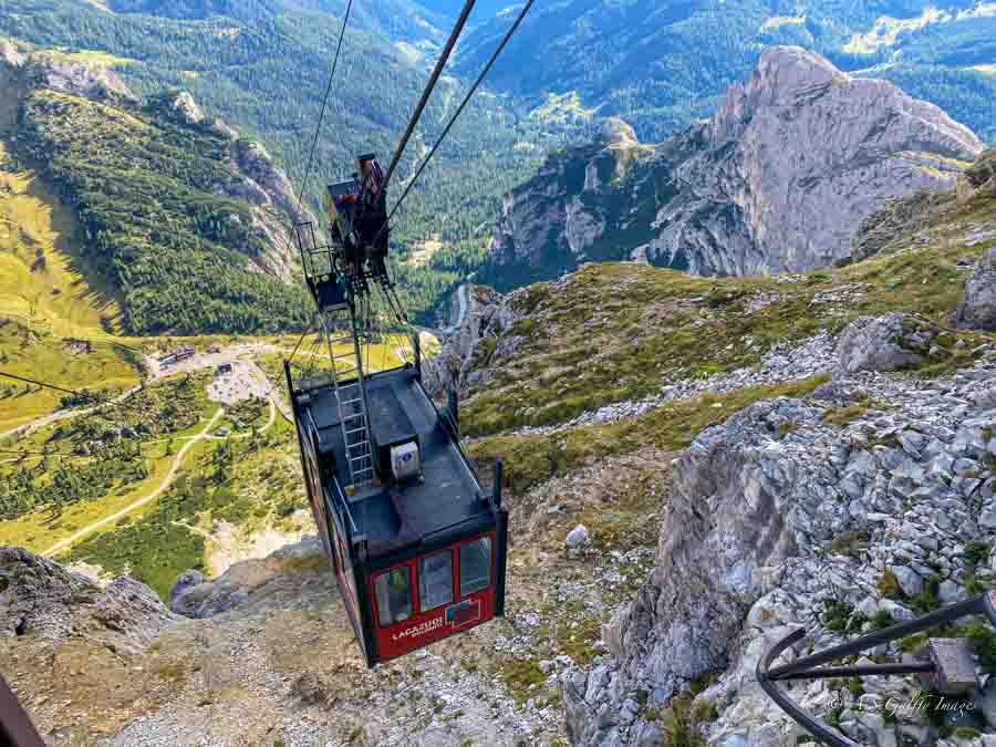
Just a few minutes away from the bottom of the Cinque Torri chairlift, continuing via Passo Falzarego/SR48 for about 4 km, you can reach another amazing point: Lagazuoi mountain. The near-vertical mountain is famous for its steep ridges, narrow pinnacles, and vertical rock faces. Lagazuoi consists of two main peaks: Grande Lagazuoi (Big Lagazuoi) at 2,835 meters (9,301 ft) and Piccolo Lagazuoi (Little Lagazuoi) at 2,778 meters (9,114 ft).
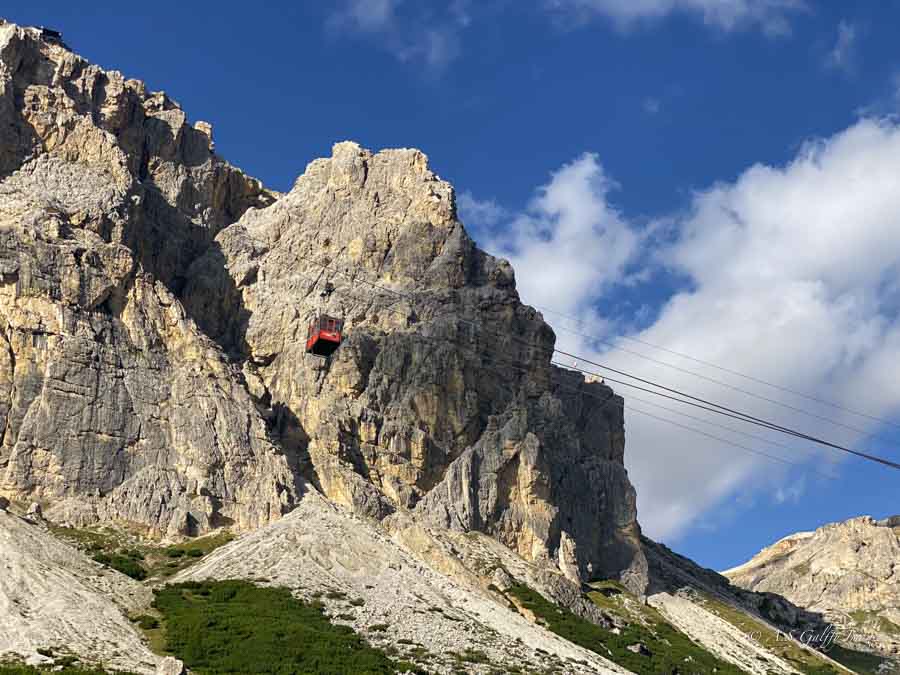
It’s worth taking the funicular to the top of the mountain, at Refugio Lagazuoi, which is just below the summit of Piccolo Lagazuoi. The ride takes only a few minutes, but ascends almost vertically up the rock face, making you a little nervous. From up here you’ll get unobstructed views of the surrounding Dolomites, including the Cinque Torri, Tofane, and Marmolada.
Sadly, we arrived a bit late and only had time for a short hike and a few photos. I recommend setting aside enough time for Lagazuoi, as there are several great trails here worth exploring. The area is an open-air museum, with restored World War I tunnels and trenches carved into the mountain by soldiers on both sides. Due to its steep, rugged terrain, Lagazuoi was a key site for “mine warfare” during the war, which is why it’s often called the “Mountain of War.”
Hiking Options at the Top of Lagazuoi:
- Easy Walking/Views: If you don’t have time to hike, simply explore the area around the top station and the Lagazuoi refuge.
- WW1 Tunnels: You can hike down through the 1 km long, steep and dark tunnels. If you want to do this hike, you’ll need a headlamp.
- Frontline Trail: This is a well-marked, panoramic, but rocky trail that connects the top station to the Falzarego Pass, allowing you to walk down the mountain.
- Kaiserjäger Trail: A more advanced path with a suspension bridge, ideal for panoramic views and historic sites.
While the summit is easily accessible by cable car, hiking up to the top from the valley is very difficult. It involves steep, challenging trails, such as the Via Ferrata Tomaselli, which has near vertical and demanding sections.
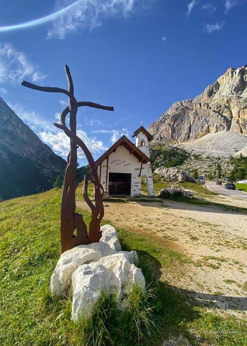
At the bottom of the funicular, there is a small, scenic chapel often photographed against the dramatic Lagazuoi backdrop. The chapel is a notable landmark that serves as a peaceful spot amidst the historic WWI battlefield area.
Tips for Your Visit to Cinque Torri
Arrive Early to Beat the Crowds
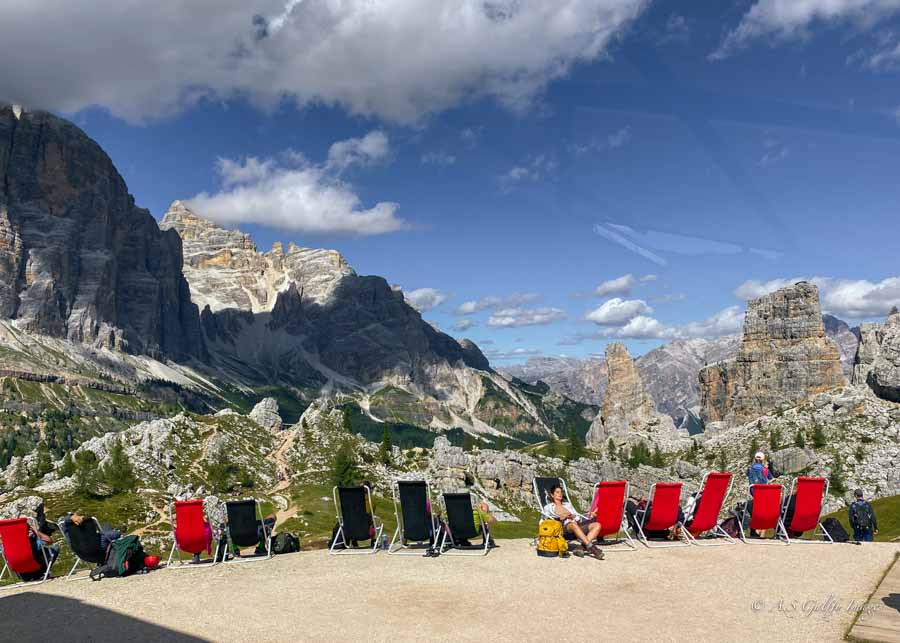
The chairlift opens at 9:00 AM, and arriving at opening time gives you significant advantages. You’ll have the trails largely to yourself for the first hour or two, making it easier to take photos without other hikers in the frame. More importantly, arriving early ensures you’ll get a table at Rifugio Scoiattoli or the other mountain huts—by midday, every table is typically taken, and you may have to wait or eat standing. If you’re planning to hike to Rifugio Nuvolau, an early start also gives you plenty of time to complete the extended route without feeling rushed.
Pro Tip: Photography Timing
Timing matters for photography at Cinque Torri. When viewed from Rifugio Scoiattoli in the morning, the towers are backlit, which creates dramatic silhouettes but can make detailed shots challenging. For the best light on the rock formations, plan to photograph them in the afternoon when the sun illuminates the towers from the front. If you’re serious about photography, consider doing the loop twice—once in morning light for atmospheric shots, then again in the afternoon for detailed tower photographs.
Download Offline Maps
Cell service can be spotty at this elevation, so download offline maps before your visit. The trails are well-marked, but having a backup navigation option provides peace of mind, especially if you’re adding the Rifugio Averau and Nuvolau extension where trails can be less distinct in places.
Check Weather Conditions
Mountain weather changes quickly in the Dolomites. Check the forecast before heading out and be prepared to adjust your plans if storms are predicted. Thunderstorms can develop rapidly in the afternoon during summer months, so morning hikes are often safer. The chairlift may close in high winds or lightning, potentially stranding you at the top if you’re not paying attention to weather developments.
Bring Cash for Rifugios
While some rifugios accept cards, cash is more reliable at mountain huts. Bring euros in small denominations for drinks, meals, or souvenirs. This also speeds up service during busy lunch hours when lines can form at the cashier.
Explore the WWI Sites Thoroughly
Don’t rush through the World War I trenches and bunkers—they’re a unique historical feature that sets this hike apart from other Dolomites trails. A small flashlight or your phone’s flashlight helps illuminate the darker bunker interiors. Take time to read the informational plaques that explain the strategic importance of this position during the war, adding educational context to your hike.
Essentials to Bring to Your Cinque Torri Hike
Even though this is considered an easy hike, it’s important to be prepared for it. There are a few essentials that we always pack, whether we hike in the Chilean Patagonia, in Arizona, or in Hawaii. Bring at least 1 liter of water per person, some snacks, and sunscreen. That comes in handy even if you don’t hike in summer because there is very little shade on this trail. Also, wear sturdy walking shoes or hiking boots with good tread, as some sections can be rocky and uneven. If you plan to hike to Avereau and Novolau, you may also want to bring hiking poles.
A light jacket always comes in handy since weather can change quickly in the mountains, even in summer. If you plan to explore the WWI trenches, bring a small flashlight or headlamp for the darker bunker sections. Finally, don’t forget your camera or phone—the photo opportunities are exceptional throughout the entire hike.
READ NEST: Is Cinque Terre Worth Visiting? A Comprehensive Review
Frequently Asked Questions About This Hike
The best time to visit is from mid-June through early October when the chairlift operates and weather is most stable. July and August offer the warmest weather but also the largest crowds. September is ideal for quieter trails with pleasant temperatures and the possibility of autumn colors at lower elevations.
Yes—you can take the chairlift up to Rifugio Scoiattoli and enjoy the views from the terrace without doing any hiking. There’s also a short, flat path from the rifugio that provides excellent views of the towers with minimal walking required.
The main Cinque Torri loop is suitable for children ages 5 and up who are comfortable with moderate hiking. The trail is well-maintained without dangerous drop-offs, and the WWI trenches add an educational element that kids often enjoy. The Nuvolau extension is more challenging and better suited for older children and teens with hiking experience.
The nearby Lagazuoi cable car and WWI tunnel hike make an excellent same-day pairing with Cinque Torri. Both attractions are just a short drive away along the Passo Falzarego route. Alternatively, explore the charming town of Cortina d’Ampezzo, about 20 minutes away, for shopping, dining, and strolling through this iconic Dolomites resort town.
 Where to Stay in Lake Garda: Best Towns & Hotels for First Time Visitors


Laszlo
Hiking the Dolomites was one of my dreams fulfilled last summer! I have visited the Swiss Alps, the Dinarites and Socha Valley In Slovenia and the Marine Alps next to Nice and Genova, but never the Dolomites. The guide is succint but comprehensive and the pictures are gorgeous! Wonderful post for a place that should be on any self respecting travelers bucket list!
Annabella mathews
What a fantastic guide! I loved how clearly you explain the easy loop trail and its breathtaking scenery in the Italian Dolomites the views around the iconic rock towers are stunning. The mix of hiking tips, practical info, and the WWI history along the route makes this post super helpful for anyone planning a visit. Thanks for the inspiration and great insights!”
Anda
Glad you liked it.
John Mark
Great article! The hike around the Cinque Torri looks absolutely stunning. I love how the trail combines beautiful alpine scenery with fascinating World War I history, making it more than just a simple hike. The fact that the loop is relatively short and accessible for most hikers makes it even more appealing for travelers exploring the Dolomites. Thanks for sharing such a detailed and inspiring guide—it definitely goes on my hiking bucket list!
Anda
A really nice hike in the Dolomite, for sure.
Sabin Ghale
Such a clear and inviting guide easy to follow, beautifully described, and perfect for anyone wanting Dolomites views without a tough hike. The mix of scenery, history, and practical tips makes this a really helpful read.
Anda
Thanks for taking time to comment.
Fiora
Anda, I enjoyed reading about your hike in the Dolomites. It’s a gorgeous place any time of the year!
Anda
I agree. Sadly, we only had 3 days there.
Debbra Dunning Brouillette
Beautiful photos! You and your husband are very adventurous travelers! I always love following along on your travel adventures around the world.
Anda
Thank you for taking time to comment, Debbie. We are lucky to still be able to do it.
Priscilla Willis
Stunning photos as always, Anda! I love that your travel writing always includes your outdoor adventures with Laz. Keep up the great work!
Anda
Thank you, Priscilla.