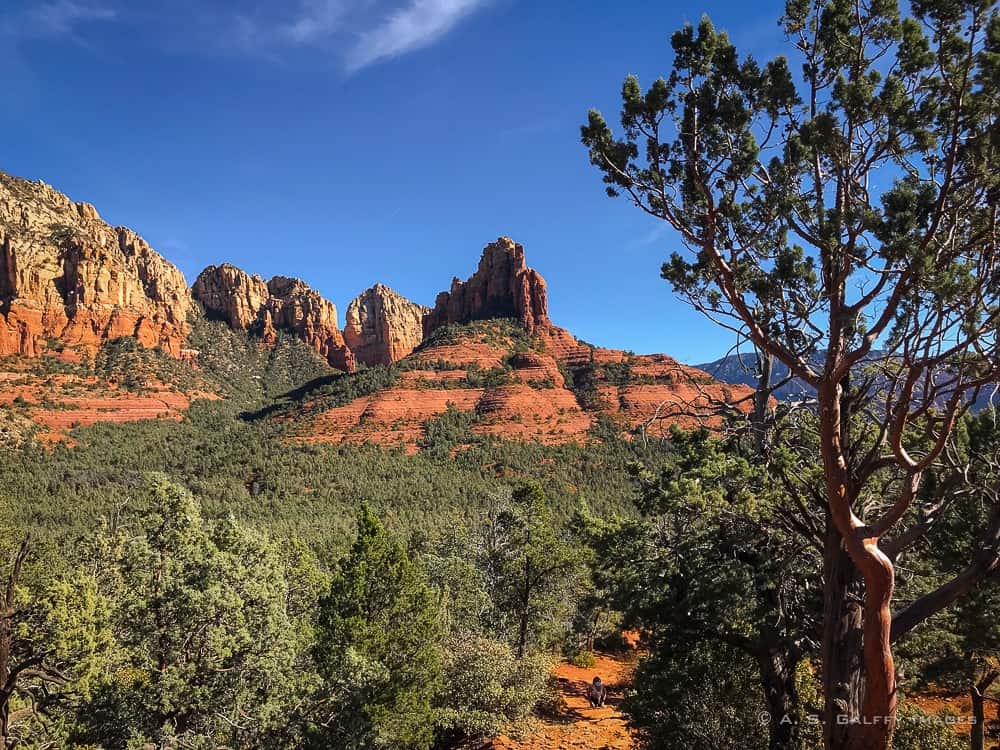
If you like red cliffs, blue skies and a little challenge, there is no better way to experience it all than hiking the Brins Mesa – Soldier’s Pass Trail Loop. This is one of the most popular hikes in Sedona, Arizona.
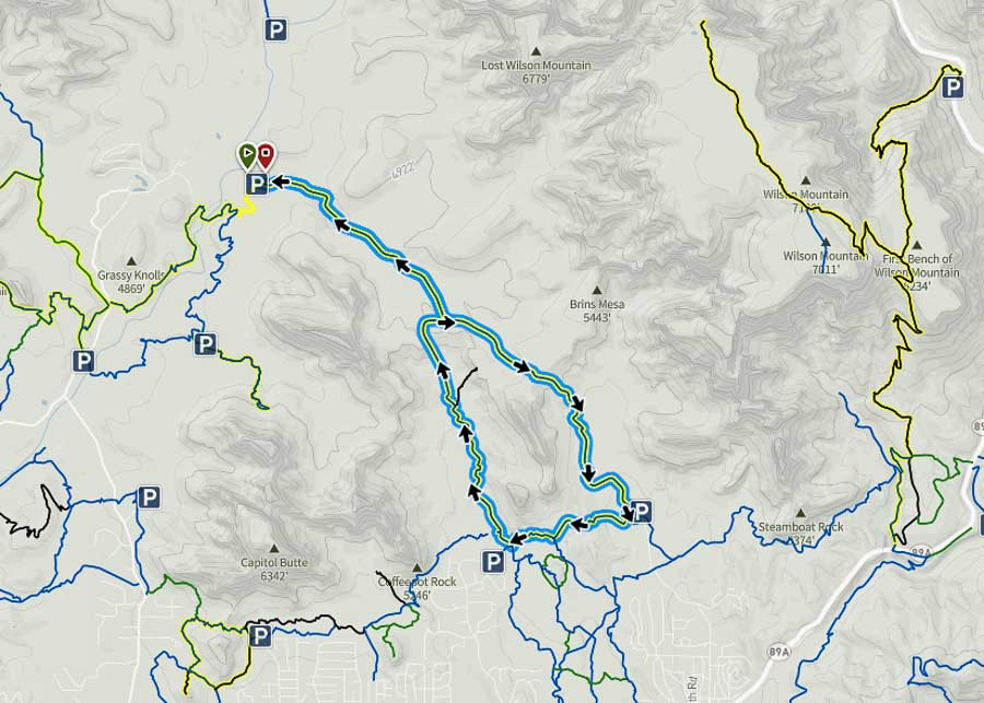
The Brins Mesa and Soldiers Pass trails form a 5.2 mile loop through stunning red rock formations and open desert. We started our hike on the Brins Mesa Trail and returned on Soldier’s Pass because Brins Mesa seemed less steep and therefore easier on the way up. It’s not that much difference however, so you can start either way.
GENERAL INFORMATION
Loop Length: 5.2 miles round trip
Elevation gain: 546 feet
Level of difficulty: Moderate
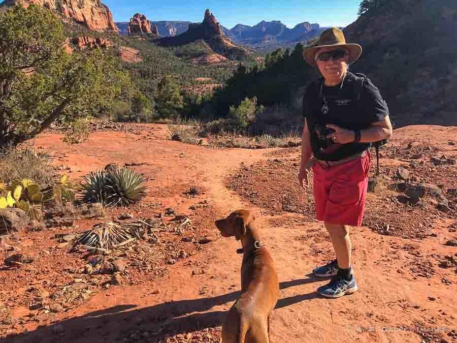
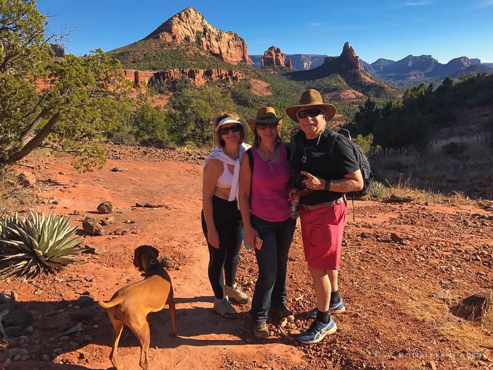
Dogs are allowed but they have to be kept on leash
Fee/Permit: $5.00 Daily Red Rock Pass, or Interagency Pass
HOW TO REACH THE BRINS MESA TRAILHEAD
Directions from Sedona: the Brins Mesa parking lot is located at the end of Jordan Road, which is off Highway 89A in downtown Sedona. The last part of the road is dirt and gravel but well graded. The Brins Mesa trailhead is located off of the gravel road, just to the left of the restrooms.
Directions from Phoenix: go north on I17 to exit 298 for Sedona/Oak Creek. Turn left (west) onto SR179 and continue to the traffic circle intersection at SR89A. Veer left through the circle heading toward Cottonwood on SR89A.
Between milepost 372 and 373, turn right onto Soldier Pass Road, drive 1.5 miles to Rim Shadows, turn right and continue 0.25 mile to the short drive to the trailhead on the left.
READ NEXT: The Ultimate Guide for Hiking the Cathedral Rock in Sedona
HIKING THE BRINS MESA TRAIL
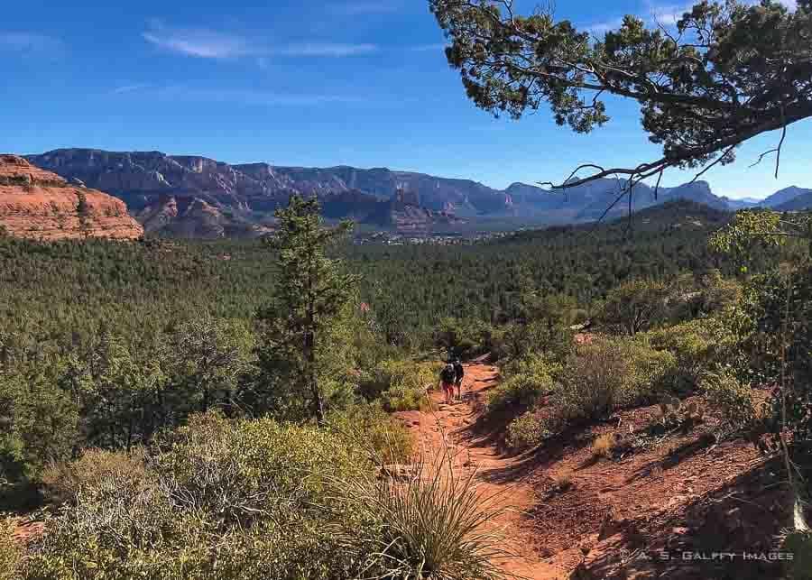
The first section of the road climbs up to an elevation of 600 feet, passing by cypress trees, juniper, yucca, manzanita, prickly pear and agave. Because you don’t have water around, hiking Brins Mesa is not as scenic as hiking Havasu Falls trail, or the Red Rock Crossing, but it’s equally impressive.
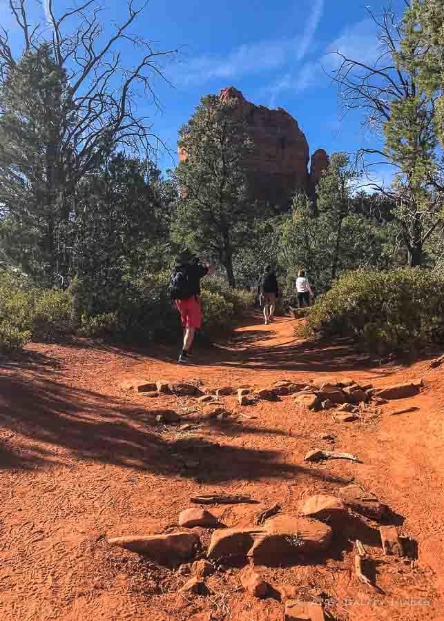
After about 1 mile, the path becomes steeper, turning into a stone-stepping climb all the way to the top. There are lots of stair and stepping rocks, so attempting this hike when the temperatures are high may be difficult.
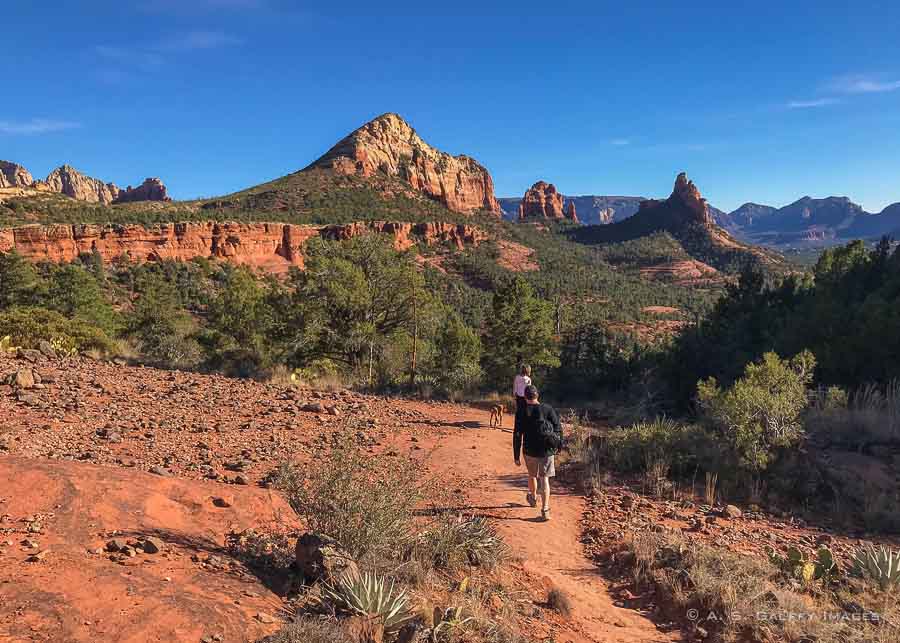
Once you reach the mesa top, the grade levels and drops down gently into a plateau. This is where the two trails (Brins Mesa and Soldier’s Pass) merge. From up here you’ll have sweeping views across the adjacent canyon, all the way to the Lost Wilson Mountain.
On the Brins Mesa Trail you can enjoy unobstructed views of the spectacular red rock formations for which this area is so famous. If you bring a map, you can identify the Coffee Pot Rock, Chimney Rock and more.
GOING DOWN ON THE SOLDIER’S PASS TRAIL
After spending a little time admiring the view from the top, we turned left and continued down on Soldier’s Pass Trail. Soldiers Pass Trail is a moderate hike down, although very dusty.
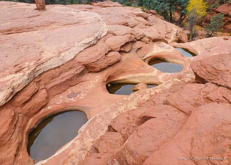
The trail rolls through a number of arroyos and past the Seven Sacred Pools, a series of deep filled potholes carved in sandstone.
The Soldier’s Pass Trail climbs over the pools and continues to the Devils Kitchen Sinkhole. The hole was formed by a series of catastrophic geological events when the sandstone layers collapsed.
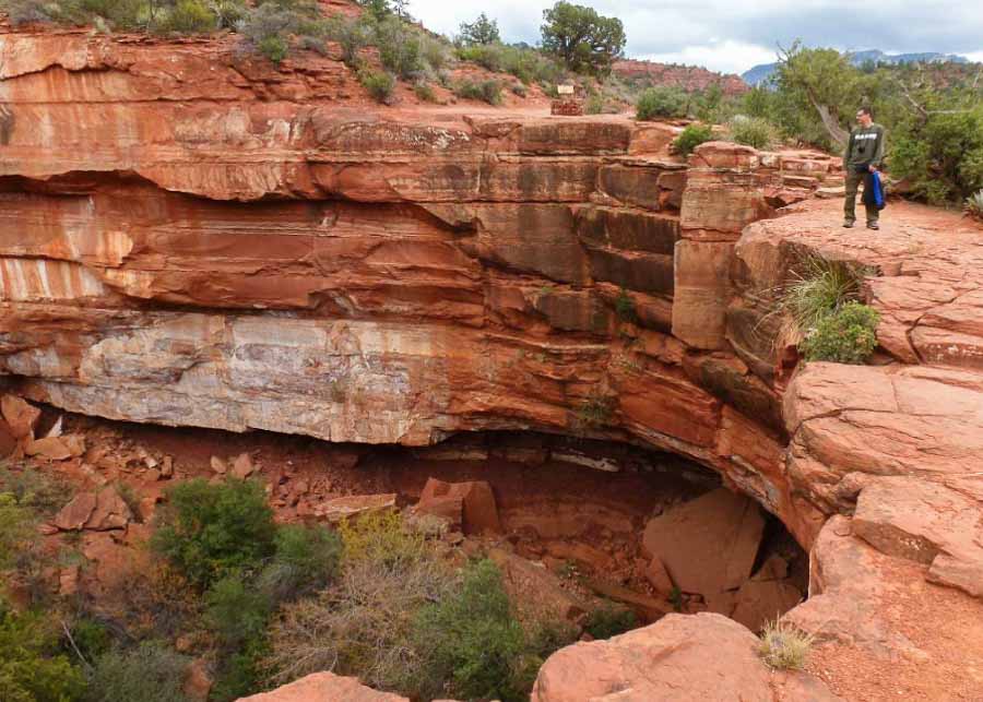
This is a scary sinkhole (about 40-50 feet deep). It’s very tempting to get close to the edge to see it closer, but you should be careful because the rocks are loose.
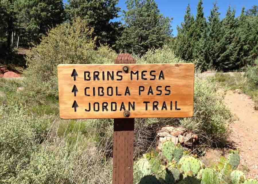
Shortly below the Devil’s Kitchen Sinkhole you’ll be arriving at Jordan trailhead. This is where we became really confused.
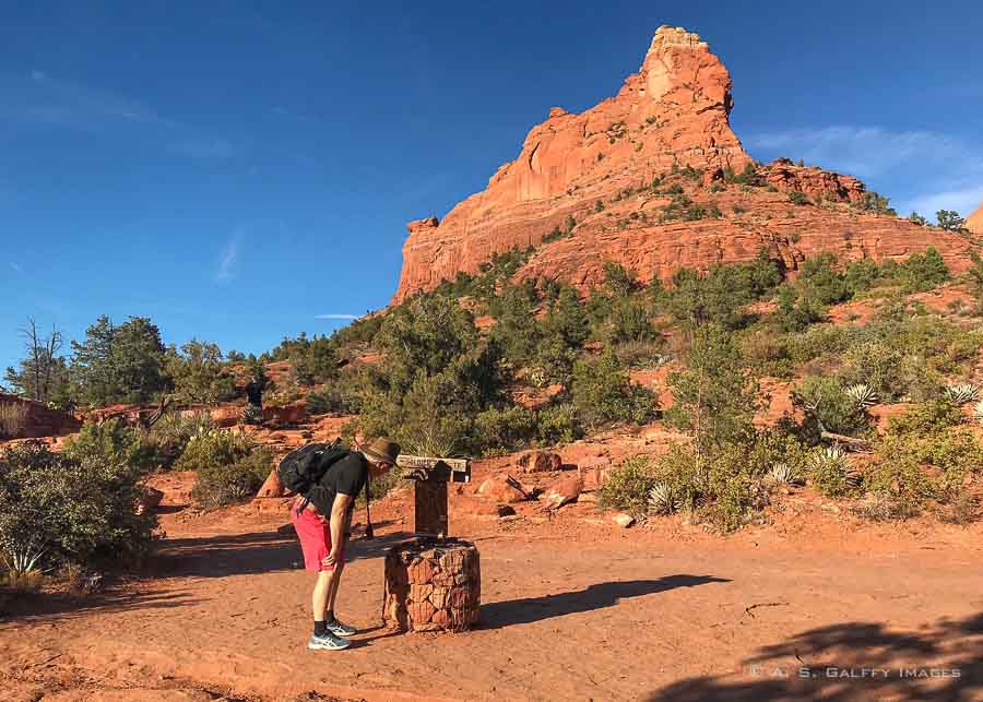
According to our map, the Soldier’s Pass Trail connected directly with the Cibola Pass, when in fact we had to walk a short distance on the Jordan Trail to reach Cibola. Luckily, we made it down before dark!
Note: Some maps prior to 2009 have the Brins Mesa trailhead and parking lot next to Jordan trail’s trailhead. Since then, the parking lot has been extended and is now next to Cibola Pass Trailhead. Thus, on the return, take Cibola Trail as it branches north off of Jordan Trail.
TIPS FOR HIKING THE BRINS MESA-SOLDIER’S PASS LOOP TRAIL
- Daily Red Rock Passes ($5) can be purchased on site at the automated fee station. Only credit cards are accepted.
- There is very little shade on the trail, so bring a hat, sunglasses and some sunscreen.
- Bathroom facilities are only available at the trailhead.
- Bring enough water as appropriate to the season you are hiking. There is no potable water on site.
- Use comfortable shoes, preferably hiking boots that keep your ankle steady. The terrain is very rough in some parts.
PLANNING A TRIP TO SEDONA? YOU MAY ALSO LIKE THESE:
- Hiking the Red Rock Crossing Trail in Sedona
- Where to Find the Best Preserved Indian Ruins in Arizona
- Jerome, Arizona – America’s Largest Ghost Town
- How to Spend One Day in Sedona
- 5 Sedona Wineries to Visit on Your Next Trip


Jennie
Thank you for these hiking tips! They are very helpful. Brins Mesa looks amazing
Daniel
I never visited in Arizona and havent heard about the Mesa trail before but it seems amazing! I’ve heard some cool stories about the red cliffs of the Southwest but now after reading this post I know I have to visit someday. The surrounding scenery is jaw-dropping too. Thank you for this lovely recommendation
Arnav Mathur
Being an outdoor person myself, I loved reading this article. I always try to explore the nature as well, when am headed to a new place, by going on short hikes in to the wilderness. While the Brins Mesa Trail looks more on the dusty side, something which is new for me, I would still love to hike and experience the adrenaline rush.
Amar Singh
I must say I had not heard much about it or ever thought if visiting this part of the wirjd but thanks to pists like yours shows us new destinations. I woukd love to hike Brins Mesa Trail in Sedona but I guess with 2 little kids might be a challenge so will wait for the to grow up a bit. The scenery is absolutely stunning with the colours of the landscape against the blue skies. I must say it’s not the easiest but pays for the hard work and visuals are rewarding. Thanks for sharing.
Anjali W
The Brins Mesa Trail hiking trails in Sedona looks really incredible. I love such trails which have such eye catching and unique surroundings. Your pictures have really fascinated me towards this hike trail in Sedona and I can’t wait to plan a hiking trip there soon.
emman damian
I haven’t been in Arizona. I really want to try the Brins Mesa Trail. I would love to walk and explore the area. It’s going to be a sweaty one though. I guess I should start training to trek now.
Jane Dempster-Smith
I enjoy reading your stories Anda on your hikes. I have always wanted to visit Sedona and hike some of the trails. Your photos are amazing! Can you get a map online or is there a visitors centre where you can purchase them? Thanks for the information.
Anda Galffy
There is a visitor center in Sedona where you will get a lot of free information.
Sinjana Ghosh
Mesa trail looks so amazing. I see some similarity with the landscape of the Grand canyon too. Thanks for all the details of the route and spots to look out for. will be very useful when we go there.
Anda Galffy
Hope you’ll get to hike this trail, Sinjana. Sedona is really beautiful.
Shreya Saha
I agree, the scenery is jawdropping indeed! The photo with the complete view of the red-cliff mountains has intrigued me much. I am sure the little challenge was worth for that picture-perfect view of red cliffs against blue sky.
Jen Morrow
Sedona has such spectacular hiking spots. It has been far too many years since I hiked Brins Mesa trail and the surrounding areas. I may be due for another visit.
Sharon
What inspiring photos! I’ve never been to Sedona, but I have wanted to visit for a long time. It looks like a great place for a hike among the beauty of nature.
Anda Galffy
Thank you, Sharon. Hope you’ll get to visit Sedona someday. It’s quite beautiful.
Jessica Norah
The hike looks fun and scenic (as long as it is not on a scorching hot day!). I don’t think I have been to Sedona, but I have seen a Chimney Rock so it threw me, but I think it was another one 😉 I have spent a little time in Arizona, but would love the opportunity to spend more time there in the future as there are so many beautiful spots!
Anda Galffy
Arizona is a good place to “warm up” after spending some time in Edinburgh, Jessica.
Ruth
My first visit to Sedona was about getting to know the area so, we focused on seeing the main spots and didn’t do a lot of hiking (plus, the trip was taken after a very sad event). I would like to go back and walk the trails. Plus, I will like to rent a jeep for a day and ride to the most gorgeous spots.
Anda Galffy
Renting a jeep sounds like a lot of fun, Ruth. You definitely should go back to Sedona for some hiking.
Maggie
This hiking trail is gorgeous – the US have the best hiking trails!
Anda Galffy
I agree, Maggie.
Lyn aka The Travelling Lindfields
We have been to Sedona more than once but never done any hiking in the area – something for our next trip I think. The red rock reminds me of the Kimberley region in Western Australia which also has rocks and gorges in stunning reds.
Anda Galffy
I’d love to visit the Kimberly region too, Lyn. Hopefully someday …
jill
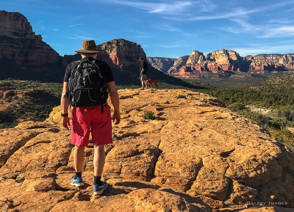
I have always loved the red cliffs of the Southwest also. This looks like a good hike to do amongst those red cliffs. I love the photo from ground level – with the man and his dog – which gives you an all over view of the cliffs. Wow!
Anda Galffy
That’s our dog, Jill. I agree, the view from up there was spectacular.
Rhonda Albom
I have hiked in Arizona and been to Sedona but I have never hiked in the red rock areas. They are so I pretty that I must make it there one day (as well as the Big 5 in Utah.) My camera can’t wait 🙂
Anda Galffy
I am not aware about the Big 5 in Utah, Rhonda. I should check that. Bryce Canyon is another place that I’d love to return too. Also a photographer’s dream.
Esther
That landscape looks spectacular. On my list for my next US trip! Thank you for hosting the linkup this week!